Hurricane Ida's devastation SHOCKS in viral before and after aerial pictures

Hurricane Ida has changed the course of life for hundreds of thousands as they scramble for food, gas and water. Such has been the devastation in Louisiana that it has described as a 'war zone'.
New aerial imagery from NOAA's National Geodetic Survey is giving us a before and after look at the damage caused by the hurricane that lashed southeastern Louisiana with intense winds and surges.
In a series of images, one can see the damage in areas where NOAA's aircraft surveyed through Monday, August 30. With 150-mile-per-hour winds, Ida was the fifth-strongest hurricane to ever make landfall in the US when it barreled across the South on Sunday night. Additional imagery will be gathered by NOAA for other impacted areas in the days ahead. The shocking images have caused quite a stir on social media as many frantically spoke about the devastating aftermath and prayed for the well being of those in Louisiana.
READ MORE
Hurricane Ida forces Mississippi river to 'flow backwards' in epic fury of nature
Terrifying videos show trees falling on homes, roofs blown off during Hurricane Ida
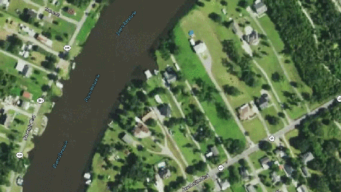
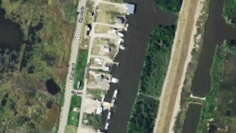
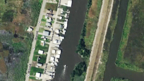
In the first two image comparisons, one can see the storm-surge flooding Jean Lafitte, which is just over a 20-mile drive south of New Orleans.
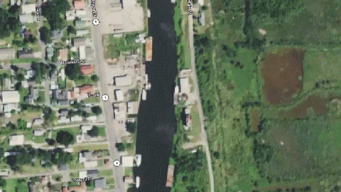
In the next upload, severe damage to structures is seen in the aerial view of Galliano, which is just inland from where the center of Ida came ashore.
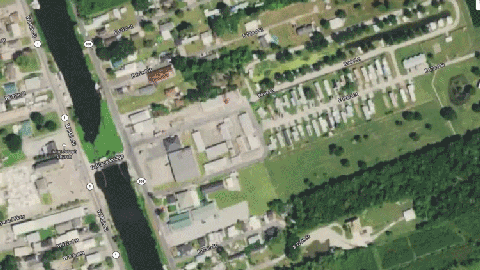
Boats blocking Bayou Lafourche and the resulting wind damage are shown here in Golden Meadow, which is located just inland from where Ida made landfall.
One can see the damage to structures near the coast just north of Cocodrie, or south of Houma, in the next two before and after images.
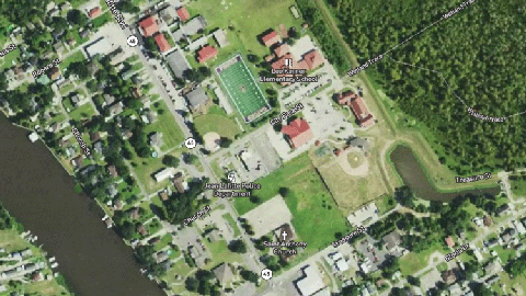
One can also see severe wind damage to a school roof near Sarah Plantation, or just southeast of Houma.
With power outage, people are struggling for relief from the sweltering heat. As officials vowed to set up more sites where people could get free meals and cool off, thousands of line workers tried to restore electricity. However, officials have said restoring power could take weeks. More than 1.1 million homes and businesses remain without power after the storm, and at least five people have been confirmed dead.
"We have a lot of work ahead of us and no one is under the illusion that this is going to be a short process," Louisiana Gov John Bel Edwards reportedly said. State Sen Gary Smith reporteedly said, "It looks like a war zone or a bomb went off throughout [St. John the Baptist] parish. There's no part that's unaffected."
The Category 4 storm has caused an estimated $80 billion in damage and sparked fears of a national fuel shortage after gas refineries were forced to suspend operations. The National Weather Service issued a heat advisory for Louisiana and Mississippi for Tuesday, affecting more than 2 million people, who could face heat indices of up to 105 degrees.
"Praying for all those affected by this devastating hurricane," one user tweeted. Another added, "Prayers for Louisiana. Look at the scale…"
Praying for all those affected by this devastating hurricane.
— Linda (@lindarevey) August 31, 2021
Aerial video, images illustrate scale of damage left by Hurricane Ida in Louisiana https://t.co/SnmUQVEoZy via @Yahoo
Prayers for Louisiana. Look at the scale…. Aerial video, images illustrate scale of damage left by Hurricane Ida in Louisiana https://t.co/5j6FhvBqmD
— Lucy Bustamante - News Anchor/Journalist (@LBustamanteNBC) August 31, 2021


